The perfect line of site.
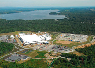
Establishing the heights and visibility of proposed structures are critical components of project planning and design. The LA Group provides visual impact assessments and analyses for numerous projects including wireless communication, resort development, landfills, amusement parks, zoning, national parks and scenic vista protection.
The process for visual impact analysis is similar for all projects and involves a combination of regional mapping using digital elevation models (DEM), collection of field data using a GPS data logger, photography and careful observation of the visual setting. Frequently, multiple target balloons are flown at a site to assist in the establishment of the area of disturbance for the visual simulation.
A scaled simulation of the proposed structure is then created photographically by combining the data into the DEM.